-
29 Aug 2024
If I'd grown up online I might feel differently about the last five years, but without physical human interaction, the bite-sized epistolary nature of social media seems hollow. You're great, but you're better in person. (more...)
-
20 Aug 2024
Once, Saint-Exupéry “circled the airport for an hour after returning, so that he could finish reading a novel.” I deeply empathize. (more...)
-
5 Feb 2024
This is a continuation of Going Into Depth, examining the construction of a custom parallax shader in WebGL, doing something I've wanted to try forever. There will be math, but also pictures, and isn't that the best case scenario? (more...)
-
8 Nov 2023
This post describes a variation on parallax mapping that I used for a recent project, with detailed examinations of the rationale and a breakdown of the technique in the abstract. (more...)
-
2 Oct 2023
In fact from now on when somebody asks “How much work would it take to get this to production?” my answer will be “How much of it did we actually write?” (more...)
-
16 Jun 2023
Is this how sociologists feel? Like staring at the matrix, but it's all creative writing workshop meetup output? I don't want to be this predictable. Is it taking cues from my other posts? Where does it get this stuff? (more...)
-
21 Nov 2016
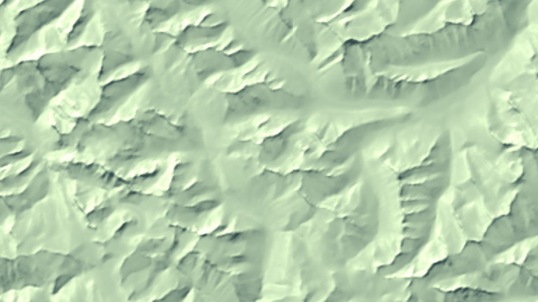
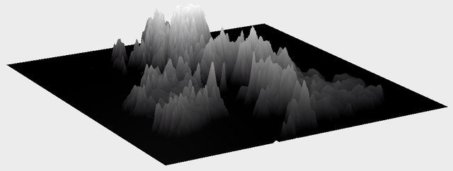
Generalization blending is a way to solve two problems at once – terrain data contains small details which aren't necessary for understanding the shape and location of important features, but basic simplification methods such as blurring are applied everywhere indiscriminately. (more...)
-
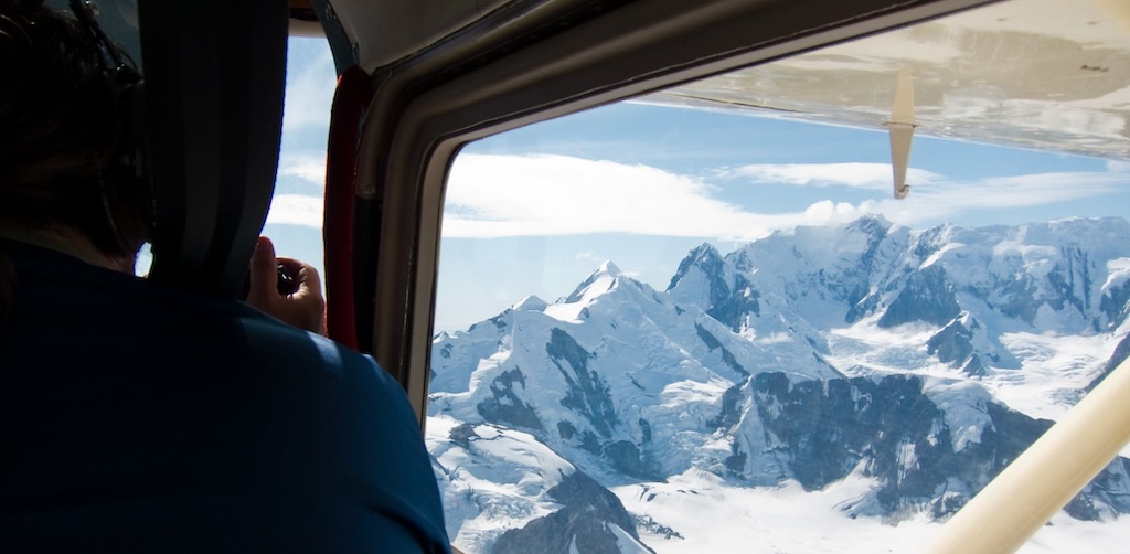
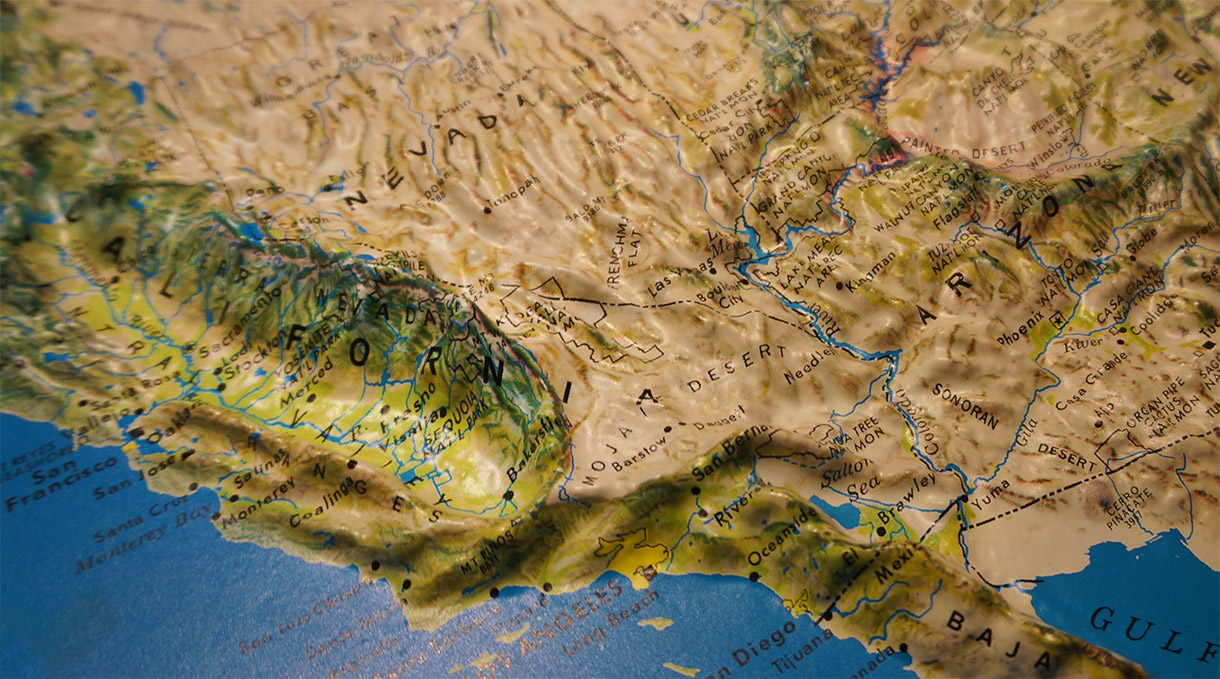
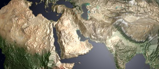
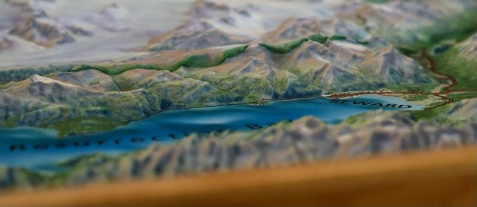
22 Mar 2016
To view mountains from above is to journey through time itself: over ancient shorelines, the trails of glaciers, the marks of countless seasons, and the front lines of perpetual tectonic struggle. Fly with me now, on a tour through the world of elevation data! (more...)
-
26 Oct 2015
Mercator projections are well-known for their distortion at high latitudes – this is because they place the north and south poles at positive and negative infinity, which means a Mercator map of the whole world would be infinitely tall. (more...)
-
7 Oct 2015
It's 82 degrees outside, all the palm trees are imported, and the auditorium seats a thousand. I try to relax. (more...)
-
11 Mar 2014
This representation isn’t “to scale” in the Cartesian sense, though maybe it’s to scale emotionally. I’m adjusting levels until they’re within the range of human feeling. It’s a theme-park, Le Petit Prince, Mario Galaxy kind of feeling, a cartoon. (more...)
-
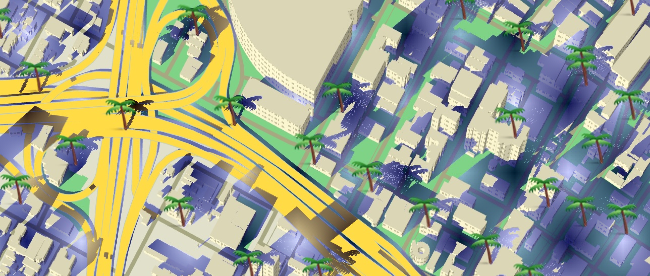
6 Sep 2013
Web 3D is finally taking off, thanks to new code libraries and cooperation from browser makers. Here’s a look at its current state as seen in my experiments with three.js, a popular web 3D library. (more...)
-
8 Aug 2013
I have a lot of questions. I blame the fact that I grew up in a fjord. (more...)